|
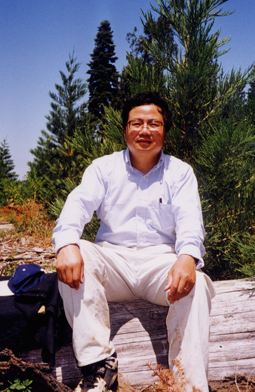
Professor School of Geosciences College of Arts and Sciences
|
|
|
|
|
Dr. Ruiliang Pu received an M.Sc (1985) from Nanjing Forestry University (NFU), China, and earned a Ph.D. (Cartography & Geographic Information System, 2000), conducted at University of California (UC) at Berkeley, from Chinese Academy of Sciences. He was a visiting scholar between 1990-1991 in Institute for Space and Terrestrial Sciences, Ontario, Canada. He was a visiting scholar at The University of Calgary, Canada, in 1994. He moved to the United States in 1995. He was a Research Associate later on an Assistant Researcher at UC Berkeley between 1995 and 2005. He has worked for one year as a Visiting Research Scientist with Earth System Science Interdisciplinary Center, University of Maryland at College Park before moving to University of South Florida (USF) in 2006. He has published more than 120 journal papers, book chapters and segments in English and more than 26 journal papers and books in Chinese. He has been awarded the science and technology prizes three times by the Chinese government between 1986 and 1991 because of his excellent research achievements. He has been a reviewer of USA NASA, Canada NSERC and Belgian Science Policy research proposals and more than 20 journals’ papers. He also is currently an editorial board member/academic editor of Remote Sensing journal and Associate editor of Geosciences journal with MDPI.
Dr. Pu is currently a Professor with School of Geosciences, USF and his research experience and interests are in remote sensing, GIS and spatial statistics with direct applications to natural hazard monitoring, land use/cover change detection, biophysical and biochemical parameters extraction, and coastal and terrestrial ecosystems modeling. His current research interests are in mapping and characterization of seagrass habitats using spacecraft observations and urban environmental studies using thermal and optical remote sensing data with an emphasis on analysis of high spatial and spectral resolution satellite imagery.
·
2000: Ph.D., Cartography & Geographic
Information System, conducted at UC Berkeley, and
Dissertation: An exploratory analysis on in situ hyperspectral data of
conifer species
·
1985: M.Sc., Forest Management, Remote
Sensing in Forestry,
Thesis: Application of remote sensing techniques in forest environment
modeling.
·
1982: B.Sc., Forestry, NFU,
Essay: Aerial photo interpretation for bamboo resource inventory.
Remote Sensing Image Analysis and Application
• Multi-platform remote sensing analysis in biogeography
• Wildland fire hotspot
detection and burn scar mapping
• Retrieval of land surface temperature (LST) from thermal sensors
• Imaging spectrometer data analysis to surface process modeling
• Urban ecological analysis
• Seagrass and coastal wetlands mapping and characterization
• Environmental modeling
• Land use/cover change detection
• Invasive species mapping and monitoring
• Forestland classification and evaluation
Geographic Information System Analysis and Application
• Landscape dynamic planning and evaluating
• Environmental resources management
• Land systems classification
• Natural resources evaluation and monitoring
• Watershed planning and modeling
Quantitative and Computer Analysis Technologies
• Multivariate and spatial statistical analysis methods
• Geospatial modeling approaches
• Quantitative analysis methods and application
• Neural network analysis in environmental science
• Remote sensing image processing and analysis
• Computer programming in C(VC, C++)/FORTRAN
Major Analysis Softwares
• Advanced PCI Geomatica, ERDAS Imagine, & ENVI image analysis systems
• ESRI ArcGIS analysis softwares
• SAS/Matlab/SPSS/Splus statistical analysis software/tools
Teaching
2018- Professor, School of Geosciences,
University of South Florida
2012-2018 Associate Professor, School of
Geosciences, University of South Florida
2006 -2012 Assistant Professor, Department of Geography, University of South Florida, courses:
· Remote Sensing of the Environment at undergraduate level
· Advanced Remote Sensing at graduate level
· Research Methods in Geography at undergraduate level
·
·
Environmental Applications of GIS at graduate
level
1995-2005 Assistant Researcher, Staff Research
Associate, Department of Environmental Science, Policy, and Management (ESPM),
The
Short courses, seminar and training:
· PubHlth/ESPM290: Remote sensing and GIS in public health for undergraduate students
· ESPM298: Advanced remote sensing in natural resources for graduate students
· Hyperspectral remote sensing and its application for graduate students
· Atmospheric correction to satellite imagery for graduate students.
· PCI EASI/PACE, Arc/Info & ArcView softwares trained to CAMFER’s visitors and workers
· Major GPS equipment and spectroradiometer trained to CAMFER’s visitors and workers
·
Guest lectures: Hyperspectral remote sensing in
30 hours each, in 1999 and 2001
respectively, for graduate students and young scholars
1993-1994: Associate Professor, Department of Forestry, NFU,
· Remote sensing image processing for graduate students
· Remote sensing in natural resources for graduate and undergraduate students
·
1985-1992: Assistant Professor, Department of Forestry, NFU,
· Remote sensing in natural resource for undergraduate students
·
·
Thesis/dissertation Advisor
2006-
Graduated master thesis:
Cynthia Meyer, master thesis committee
director (Fall 2008)
Bruce Mitchell, master thesis committee
co-director (Summer 2011)
Fenqing Weng,
master thesis committee director (Summer 2012)
James Anderson, master thesis committee
member (Summer 2012)
Steven Ulloa, master thesis committee
member (Spring 2015)
Brendon Quinton, master thesis
committee member (Summer 2016)
Zhaoxu Zhu, master
thesis committee member (Fall 2016)
Amor Elder, master thesis committee
director (Spring 2017)
Barbara Nordheim-shelt, master thesis
committee director (Spring 2017)
Carolyn Cheatham Rhodes, master thesis
committee member (Summer 2017)
Non-thesis
track:
Roderick Duplin,
master thesis committee member (non- thesis track, Fall
2007)
Sarah Kelly, master thesis committee
member (non- thesis track, Spring 2008)
Corey Denninger,
master thesis committee member (non- thesis track, Fall
2012)
Elizabeth Ciesla,
master thesis committee member (non- thesis track, Fall
2013)
Lance Knowlton master thesis committee member
(non- thesis track, Spring 2014)
Kevin Slaughter master thesis committee
member (non- thesis track, Fall 2014)
Lisa Beyer, master thesis committee
member (non- thesis track, Fall 2015)
Garrett Speed, master thesis committee
member (non- thesis track, Spring 2016)
Graduated PhD dissertation:
JoAnn Sullivan, doctoral dissertation
committee member (Summer 2010)
Shawn Landry, doctoral dissertation
committee member (Summer 2013)
Cynthia Meyer, doctoral dissertation
committee director (Fall 2013)
Sandra Kling, doctoral dissertation
committee member (Spring 2014)
Jun Cheng, doctoral dissertation
committee member (Fall 2015)
Milena Janiec Grygo, doctoral
dissertation committee member (Summer 2016)
Julius Anchang, doctoral dissertation
committee co-director (Fall 2016)
Bruce Mitchell, doctoral dissertation
committee member (Summer 2017)
Bryan Winter, doctoral dissertation
committee member (Summer 2017)
Current master thesis:
Yujia Wang, master thesis committee
co-director
Christopher Hanni, master thesis
committee director
Ruoshu Zhao, master thesis committee
member
Current PhD dissertation:
Julie Earls, doctoral dissertation
committee director (PhD candidacy in Spring 2015)
René Dieter Baumstark, doctoral
dissertation committee director (PhD candidacy in Fall
2015)
Qiuyan Yu, doctoral dissertation
committee director (PhD candidacy in Spring 2017)
Qiandong Guo, doctoral dissertation
committee director (PhD candidacy in Fall 2016)
Yousif Abdullah, doctoral dissertation
committee co-director
Rocio Lalanda, doctoral dissertation
committee member
Kevin Stofan, doctoral dissertation
committee member
Thilanki Rajaguru, doctoral
dissertation committee member
Michael Acheampong, doctoral
dissertation committee member
Augustine Israel, doctoral dissertation committee member
Research
2006- Assistant Professor, Associate Professor, Professor, School of Geosciences
University of South Florida.
o Co-PI: Comparative study of the impact of coastal artificialization on coastal geomorphology evolution.
o CO-PI: Predicting i-Tree Ecosystem Services from Remote Sensing Metrics.
o Co-PI/Science-PI: Mapping and Characterization of Seagrass Habitats Using Spacecraft Observations.
o PI: Tree species identification in Tampa Bay, FL, with hyperspectral data
o
Co-PI: Urban ecological analysis (
o PI: Development of Fire Algorithm with GOES-R ABI Simulated Data
o Co-principal investigator: Wildfire detection and monitoring using polar orbiting environmental satellite data (e.g., NOAA/AVHRR and EOS/MODIS data)
o PI: Urban environmental studies using thermal and optical remote sensing data
o PI: invasive species detection and evaluation in a terrestrial ecosystem using hyperspectral data
2005-2006: Visiting
Research Scientist, Earth System Science Interdisciplinary Center,
o Co-principal investigator: Wildfire detection and monitoring using polar orbiting environmental satellite data (e.g., NOAA/AVHRR and EOS/MODIS data)
1995-2005: Research
Associate, Department of Environmental Science, Policy, and Management, The
o Co-principal investigator: Monitoring of Sudden Oak Death and invasive species mapping using hyperspectral measurements and airborne hyperspectral data (CASI)
o
Co-principal investigator: EO-1 and Landsat
imageries analysis for monitoring
o
Co-principal investigator: Mapping of historical
burn scars (1985 - 2000) of the entire
o Co-principal investigator: Emission estimation through wildland fire hotspot detection and burn scar mapping with NOAA/AVHRR daily data using PCI EASI scripts and modelling
o Principal investigator: Land ecosystems classification with DEM, forestry data using artificial neural networks
o Principal investigator: Tree species identification and biochemistry estimation with hyperspectral data using artificial neural networks and spectral derivative techniques
o PI: Irrigate tracts classification and evaluation with Landsat TM imagery
o Co-principal investigator: Wildlife habitat classification with Thematic Mapper data and GIS using classifiers: maximum likelihood classifier and artificial neural networks
o Participate: Global change research with NOAA-AVHRR
1994-1995: Visiting Research Scientist, Department of Geomatics
Engineering, The
o Principal investigator: Evaluate the potentials of hyperspectral imagery (CASI and AVIRIS) for estimating forest canopy biochemistry
o Co-principal investigator: Correlating hyperspectral data with forest ecosystem parameters
1992-1994: Associate Professor, Remote Sensing Laboratory, NFU,
o Co-principal investigator: Exploring and modeling the relationships between vegetation change information and environmental elements
o Principal investigator: Research on forest landscape types in assessing national parks
1990-1992: Visiting Research Scientist, Earth Observations
Laboratory, ISTS,
o
Participate: The Oregon Transect Ecosystem
Research project, led by
o Participate: Calibrating imaging spectrometry data
o Principal investigator: Developing software code for calculating and mapping leaf area index from hyperspectral data coupling with PCI EASI/PACE image processing system
1985-1990: Assistant Professor, Remote Sensing Laboratory, NFU,
o
Project leader and principal investigator:
Application of remote sensing techniques in protected forest on the coastal
zone in
o Co-principal investigator: Remote sensing image analysis and applied in forestry
o Principal investigator: Interpreting ecosystem parameters from remote sensing images
o Principal investigator: Natural resource inventory study
1982-1985: Research Assistant, NFU, china.
o Principal investigator: Application of remote sensing techniques in forest environment survey in southern china.
Services
1997- Referee for reviewing following journals
• Ecological Modelling (USA). 2008-
• IEEE Geoscience and Remote Sensing Letters (USA). 2008-
• IEEE Journal of Selected Topics in Earth Observations and Remote Sensing ( USA). 2008-
• Journal of Applied Remote sensing (USA). 2008-
• Computers and Electronics in Agriculture 2007-
• ISPRS Journal of Photogrammetry and Remote Sensing 2007-
• Canadian Journal of Remote Sensing (Canada) 2007-
• Environmental Monitoring and Assessment (Netherlands) 2006-
• Remote Sensing of Environment (USA) 2004-
• IEEE Transactions on Geoscience & Remote Sensing (USA) 2003-
• Photogrammetric Engineering & Remote Sensing (USA) 2002-
• Forest Science (USA) 2002-
• International Journal of Remote Sensing (UK) 1999-
• International Journal of Digital Earth (China) 2008-
• International Journal of Wildland Fire (Australia) 2008-
• The Professional Geographer (USA) 2009-
• Annals of the Association of American Geographers (USA) 2010-
• Journal of Earth Science and Engineering (JESE, USA). 2013-
• Crop Science (USA) 2013-
• Environmental Management (USA) 2013-
• Int. J. of Applied Earth Observation and Geoinformation 2013-
• GIScience and Remote Sensing 2012-
1995 -2004 assistant editor
(Editor-in-Chief : Dr. Peng Gong), Geographic
Information Sciences (renamed to Annals of GIS), The Association of Chinese Professional in Geographic Information Systems (Abroad).
2015-16 Guest editor for a special
issue of Geosciences (MDPI AG, Basel,
Switzerland): “Mapping and Assessing Natural Disasters Using Geospatial Technologies.”
This special issue consists
of 9 papers.
2013-15 Editorial board member of Journal
of Earth Science and Engineering (JESE, USA).
2015- Editorial board member/Academic editor of Remote Sensing (ISSN 2072-4292 by MDPI).
2016- Associates Editor of Geosciences (ISSN 2076-3263 by MDPI).
2017- A member of the
Editorial Advisory Board for
Taylor & Francis Series in Remote Sensing
Applications, CRC press
Awards
o 2001: Outstanding Service Award, The International Association of Chinese Professionals in GIS
o
1991: Prize of Science Technology, second place,
by the Ministry of Forestry of
o
1991: The best scientific paper from The
Association of Remote Sensing in
o
1987: Prize of Science Technology, second place,
by
o
1988: Prize of Science Technology, third place,
by the Ministry of Forestry of
Research Grants
After moving to USF (2006-):
• R. Pu NOAA-UMD,
USA Held $20k 2007-09
Development of Fire
Algorithm with GOES-R ABI Simulated Data
• R. Pu Internal
Award, USF Held $6,953 2007-08
Hyperspectral and
High Spatial Resolution Data Analysis for mapping Tree Canopy
• Shawn Landry City
of Tampa, FL Held $100k
2007-08
R. Pu
(Co-PI) City of Tampa Urban Ecological
Analysis
• R. Pu Patel
Center for Global Solutions, USF Held $1,000 2008
International
travel funds from The Dr. Kiran C. Patel Center for Global Solutions, USF
• R. Pu CAS,
USF Held $1,000 2009
Faculty Research
& Development Grant
• Susan Bell (PI) NASA,
USA Held $359,539 2009-13
R. Pu (Sci.
PI) Mapping and Characterization of Seagrass habitats Using Spacecraft
Observations
• Shawn Landry City
of Tampa, FL Held $250k 2010-13
R. Pu
(Co-PI) City of Tampa Urban Ecological
Analysis and Management Plan 2010-2012
• Shawn Landry USFS,
USA Held $45,978 2014-15
R. Pu (Co-PI) Predicting i-Tree
Ecosystem Services from Remote Sensing Metrics
• Jialin Li National
Natural Science Foundation of China Held $160k (0.98 mil CNY) 2015-18
R. Pu (Co-PI) Comparative
study of the impact of coastal artificialization on
coastal geomorphology evolution
• Shawn Landry City
of Tampa, FL Held $225k 2016-17
R. Pu (Co-PI) 2016 Tampa Tree Canopy Study and Urban
Forest Analysis
• Jialin Li National
Natural Science Foundation of China Held $362k (2.52 mil CNY) 2017-20
R. Pu (Co-PI) Multi-sensor
and Multi-Temporal Remote Sensing Integration Techniques for Coastal Wetland
Evolution Monitoring
• R. Pu USF Held $2,500 2018
Faculty
International Travel Grant
·
2005- American Geophysical
· 2003- Association of American Geographers (AAG)
· 1995- American Society of Photogrammetry and Remote Sensing (ASPRS)
· 1995- International Society of Photogrammetry and Remote Sensing (ASPRS)
· Refereed Articles:
2018
[106] Wang, H., Y. Zhong, R. Pu,
Y. Zhao, Y. Song, and G. Li. 2018. Dynamic analysis of Robinia pseudoacacia forest health levels from
1995 to 2013 in the Yellow River Delta, China using multitemporal
Landsat imagery. International Journal of Remote Sensing, 39(12): 4232-4253,
DOI: 10.1080/01431161.2018.1455236
[105] Ma, B., R. Pu, S. Zhang,
and L. Wu, 2018. Spectral identification of stress types for maize seedlings
under single and combined stresses. IEEE Access, 6(1):13773 – 13782, DOI10.1109/ACCESS.2018.2810084
[104] Li, J., M. Ye, R. Pu, Y.
Liu, Q. Guo, B. Feng, R. Huang, and G. He. 2018. Spatiotemporal Change Patterns
of Coastlines in Zhejiang Province, China during the Last Twenty Five Years. Sustainability, 10: 477 (1 – 18), doi:10.3390/su10020477
2017
[103] Jing, R., Z. Gong, W. Zhao, R.
Pu, and L. Deng. 2017. Above bottom Biomass Retrieval of Aquatic Plants
from SfM Data Acquired by Unmanned Aerial
Vehicles−A Case Study in Wild Duck Lake Wetland, Beijing, China. ISPRS
Journal of Photogrammetry and Remote Sensing, 134:122-134. https://doi.org/10.1016/j.isprsjprs.2017.11.002.
[102] Ren, Z., Y. Du, X. He, R. Pu,
H. Zheng, and H. Hu. 2017. Spatiotemporal pattern of urban forest leaf area
index in response to rapid urbanization and urban greening. Journal
of Forestry Research, pages 1 – 12, DOI 10.1007/s11676-017-0480-x
[101] Ren, Z., R. Pu, H.
Zheng, D. Zhang, and X. He, 2017. Spatiotemporal analyses of urban vegetation
structural attributes using multitemporal Landsat TM
data and field measurements. Annals of Forest Science, 74:1-14, DOI
10.1007/s13595-017-0654-x.
[100] Guo, Q., R. Pu, J. Li,
and J. Cheng. 2017. A Weighted Normalized Difference Water Index for Water
Extraction Using Landsat Imagery. International Journal of Remote Sensing,
38(19): 5430-5445, DOI: 10.1080/01431161.2017.1341667.
[99] Ma, B., R. Pu, L. Wu, S.
Zhang, 2017. Vegetation Index Differencing for Estimating Foliar Dust in an
Ultra-low-grade Magnetite Mining Area Using Landsat Imagery. IEEE
Access, 5(1): 8825 –8834, 10.1109/ACCESS.2017.2700474
[98] Li, J. R. Pu, H. Gong, X.
Luo, M. Ye, and B. Feng. 2017. Evolution Characteristics of Landscape Ecological
Risk Patterns in Coastal Zones in Zhejiang Province, China. Sustainability, 9: 584 (1-18) doi:10.3390/su9040584.
[97] Li, J., L. Yang, R. Pu,
and Y. Liu, 2017. A review on anthropogenic geomorphology. J. Geogr.
Sci., 27(1): 109-128.
[96] Pu, R., and S. Bell, 2017.
Mapping Seagrasses Coverage and Spatial Patterns with High Spatial Resolution
IKONOS Imagery. International Journal of Applied Earth Observation and Geoinformation,
54: 145−158.
2016
[95] Wang, H. K. Lu, and R. Pu. 2016. Mapping Robinia pseudoacacia forest health in the Yellow River delta by using high resolution IKONOS imagery and object-based image analysis. Journal of Applied Remote Sensing, 10(4), 045022. doi:10.1117/1.JRS.10.045022
[94] Lin, H. R. Pu, L. Wang, C. Li, and C. Shao, 2016. High-Spectral Inversion Based on Characteristic Band in the Three-River Headwater Region of Soil Total-Nitrogen. International Journal of Simulation -- Systems, Science & Technology. 17(19): 15.1−15.14. 14p. DOI:10.5013/IJSSST.a.17.25.15.
[93] Guo, Q., R. Pu, and J. Cheng, 2016. Anomaly detection from hyperspectral remote sensing imagery. Geoscineces, 6, 56; doi:10.3390/geosciences6040056. (http://www.mdpi.com/journal/geosciences).
[92] Zhang, H., R. Pu, and X. Liu, 2016. A new image processing procedure integrating PCI-RPC and ArcGIS-Spline tools to improve the orthorectification accuracy of high resolution satellite imagery. Remote Sensing, 8: 827 (1−16), doi:10.3390/rs8100827.
[91] Baumstark, R. R. Duffey, and R. Pu, 2016. Mapping seagrass and colonized hard bottom in Springs Coast, Florida using WorldView-2 satellite imagery. Estuarine, Coastal and Shelf Science, 181:83−92.
[90] Anchang, J., E. Ananga, and R. Pu, 2016. An efficient unsupervised index based approach for mapping urban vegetation from IKONOS imagery. International Journal of Applied Earth Observation and Geoinformation. 50: 211–220.
[89] Yang, G., Q. Weng, R. Pu, F. Gao, C. Sun, H. Li, and C. Zhao, 2016. Evaluation of ESTARFM based algorithm for generating land surface temperature products by fusing ASTER and MODIS data during the HiWATER-MUSOEXE. Remote Sensing, 8, 75 (1−25), doi:10.3390/rs8010075.
[88] Zhang, M., Z. Gong, W. Zhao, R. Pu, and K. Liu, 2016. Estimating wetland vegetation abundance from Landsat-8 OLI imagery: A comparison between linear spectral mixture analysis and multinomial logit modeling methods. Journal of Applied Remote Sensing, 10(1), 015005 (Jan – Mar., 2016). doi:10.1117/1.JRS.10.015005.
[87] Yuan, L., Pu, R., Zhang, J. Wang, J., Yang, H. Yang, G., 2016. Using high spatial resolution satellite imagery for mapping powdery mildew at a regional scale. Precision Agriculture, 17(3):332−348.
[86] Guo, Q., R. Pu, L. Gao, and B. Zhang, 2016. A Novel Anomaly Detection Method Incorporating Target Information Derived from Hyperspectral Imagery. Remote Sensing Letter, 7(1): 11−20, DOI:.1080/2150704X.2015.1101177
2015
[85] Yang, G., C. Zhao, R. Pu, H. Feng, Z. Li, H. Li., and C. Sun, 2015. Leaf nitrogen spectral reflectance model of winter wheat (Triticum aestivum) based on PROSPECT: simulation and inversion. Journal of Applied Remote Sensing, 9(1), 095976 (Dec 23, 2015). doi:10.1117/1.JRS.9.095976
[84] Lin, H., Y. Tian, R. Pu, and L. Liang, 2015. Remotely sensing image fusion based on wavelet transform and human vision system. International Journal of Signal Processing, Image Processing and Pattern Recognition, 8(7): 291−298.
[83] Wang, H., Y. Zhao, R. Pu, and Z. Zhang, 2015. Mapping Robinia pseudoacacia forest health conditions by using combined spectral, spatial and textural information extracted from IKONOS imagery and random forest classifier. Remote Sensing, 7: 9020−9044.
[82] Pu, R., and J. Cheng, 2015. Mapping Forest Leaf Area Index Using Reflectance and Textural Information Derived from WorldView-2 Imagery in a Mixed Natural Forest Area in Florida, USA. International Journal of Applied Earth Observation and Geoinformation. 42:11−23.
[81] Wang, H., R. Pu, Q. Zhu, L. Ren, and Z. Zhang, 2015. Mapping health levels of Robinia pseudoacacia forests in the Yellow River delta, China, using IKONOS and Landsat 8 OLI imagery. International Journal of Remote Sensing, 36(4):1114−1135.
[80] Pu, R., S. Landr y, and J., Zhang, 2015. Evaluation of atmospheric
correction methods in identifying urban tree species with WorldView-2 imagery. Journal
of Selected Topics in Applied Earth Observations and Remote Sensing,
8(5):1886−1897.
[79] Gong, Z., T. Cui, R. Pu, C. Lin, and Y. Chen, 2015. Dynamic simulation of vegetation abundance in a reservoir riparian zone using a sub-pixel Markov model. International Journal of Applied Earth Observation and Geoinformation, 35:175−186.
[78] Pu, R., S. Bell, and D. English, 2015.
Developing hyperspectral vegetation indices for identifying seagrass species
and cover classes. Journal of Coastal Research, 31(3):595−615, DOI:
10.2112/JCOASTRES-D-12-00272.1
2014
[77] Lin, H., R. Pu, C. Zhao, and Z. Hu, 2014. Remote sensing image fusion based on the combination grey absolute correlation degree and IHS transform. Sensors & Transducers, 183(12): 177−183.
[76] Pu, R., S. Bell, and C. Meyer, 2014. Mapping and Assessing Seagrass Bed Changes in Central Florida’s West Coast Using Multitemporal Landsat TM Imagery. Estuarine, Coastal and Shelf Science, 149: 68-79. DOI: 10.1016/j.ecss.2014.07.014
[75] Zhang, J., R. Pu, L. Yuan, C. Nie, and G. Yang, 2014. Integrating remotely sensed and meteorological observations to forecast wheat powdery mildew at a regional scale. Journal of Selected Topics in Applied Earth Observations and Remote Sensing. (in press). DOI: 10.1109/JSTARS.2014.2315875
[74] Zhang, J., R. Pu, L. Yuan, C. Zhao, J. Wang, W. Huang, and G. Yang, 2014, Monitoring powdery mildew of winter wheat by using moderate resolution multi-temporal satellite imagery. PLOS ONE, 9(4): e93107. doi:10.1371/journal.pone.0093107
[73] Wang, H., J. Gao, R. Pu, L. Ren, Y. Kong, H. Li, and L. Li, 2014, Natural and anthropogenic influences on a red-crowned crane habitat in the Yellow River Delta Natural Reserve, 1992-2008. Environmental Monitoring and Assessment 186:4013-4028.
[72] Liu, L., W. Huang, R. Pu, and J. Wang, 2014, Detection of internal leaf structure deterioration using a new spectral ratio index in the near-infrared shoulder region. Journal of Integrative Agriculture 13(4): 760-769
[71] Pu, R., S. Bell, and D. English, 2014. Developing hyperspectral vegetation indices for identifying seagrass species and cover classes. Journal of Coastal Research, (in press). DOI: 10.2112/JCOASTRES-D-12-00272.1
[70] Yang, G., R. Pu, C. Zhao, X. Xue, 2014. Estimating high spatiotemporal resolution evapotranspiration over a winter wheat field using an IKONOS image based complementary relationship and Lysimeter observations. Agricultural Water Management, 133:34-43.
[69] Zhang, J., L. Yuan, R. Pu, R. W. Loraamm, and J. Wang, 2014. Comparison between wavelet spectral features and conventional spectral features in detecting yellow rust for winter wheat. Computers and Electronics in Agriculture, 100:79-87.
2013
[68] Pu, R.; and S. Bell, 2013. A protocol for improving mapping and assessing of seagrass abundance along the West Central Coast of Florida using Landsat TM and EO-1ALI/Hyperion images. ISPRS Journal of Photogrammetry and Remote Sensing, 83:116–129.
[67] Weng, F. and R. Pu, 2013, Mapping and Assessing of Urban Impervious Areas Using Multiple Endmember Spectral Mixture Analysis: A Case Study in the City of Tampa, Florida. Geocarto International, 28(7):594-615.DOI: 10.1080/10106049.2013.764355.
[66] Yang, G., R. Pu, J. Zhang, C. Zhao, H. Feng, and J. Wang, 2013. Remote sensing of seasonal variability of fractional vegetation cover and its object-based spatial pattern analysis over mountain areas. ISPRS Journal of Photogrammetry and Remote Sensing, 77:79-93.
[65] Zhao, Y., R. Pu, S. Bell, C. Meyer, L. Baggett, and X. Geng, 2013, Hyperion image optimization in coastal waters. IEEE Transactions on Geoscience and Remote Sensing, 51(2):1025-1036. DOI:10.1109/TGRS.2012.2205262.
2012
[64] Pu, R.; Bell, S.; Meyer, C.; Lesley Baggett, L., and Zhao, Y., 2012. Mapping and Assessing Seagrass Habitats Using Satellite Imagery. Estuarine, Coastal and Shelf Science, 115: 234-245. http://dx.doi.org/10.1016/j.ecss.2012.09.006.
[63] Zhang, J., R. Pu, W. Huang, J. Luo and J. Wang, 2012, Using hyperspectral remote sensing for detecting and discriminating yellow rust disease from nutrient stresses, Field Crop Research, 134:165-174.
[62] Pu, R., and S. Landry, 2012, A comparative analysis of high resolution IKONOS and WorldView-2 imagery for mapping urban tree species. Remote Sensing of Environment,124:516-533.
[61] Pu, R., S. Bell, L. Baggett, C. Meyer1, and Y. Zhao, 2012, Discrimination of seagrass species and cover classes with in situ hyperspectral data. Journal of Coastal Research, 28(6):1330-1344, DOI: 10.2112/JCOASTRES-D-11-00229.1
[60] Pu, R., 2012, Mapping leaf area index over a mixed natural forest area using ground-based measurements and Landsat TM imagery. International Journal of Remote Sensing 33(20): 6600–6622
[59] George Xian, Collin Homer, Brett Bunde, Patrick Danielson, Jon Dewitz, Joyce Fry & Ruiliang Pu 2012, Quantifying urban land cover change between 2001 and 2006 in the Gulf of Mexico region, Geocarto International, 27(6): 479–497, DOI:10.1080/10106049.2011.652675
[58] Zhang, J., R. Pu, J. Wang, and W. Huang, 2012, Detecting powdery mildew of winter wheat using leaf level hyperspectral measurements, Computers and Electronics in Agriculture, 85:13-23
[57] Meyer, C. and R. Pu, 2012, Assessment of Seagrass Resources using Remote Sensing Methods in St. Joseph Sound and Clearwater Harbor, Florida, U.S.A. Environmental Monitoring and Assessment 184:1131–1143.
[56] Pu, R., 2012, Comparing canonical correlation analysis with partial least square regression in estimating forest leaf area index with multitemporal landsat TM imagery, GIScience & Remote Sensing, 49(1): 92–116. DOI: 10.2747/1548-1603.49.1.92
2011
[55] Okwen, R. T., R. Pu, and J. A. Cunningham, 2011, Remote sensing of temperature variations around major power plants as point sources of heat. International Journal of Remote Sensing, 32(13): 3791-3805, doi.org/10.1080/01431161003774723.
[54] Pu, R., S. Landry, and Q. Yu, 2011, Object-Based Urban Detailed Land Cover Classification with High Spatial Resolution IKONOS Imagery. International Journal of Remote Sensing, 32(12): 3285-3308, doi.org/10.1080/01431161003745657.
[53] Pu, R. and D. Liu, 2011, Segmented canonical discriminant analysis of in situ hyperspectral data for identifying thirteen urban tree species. International Journal of Remote Sensing, 32(8):2207-2226, DOI: 10.1080/01431161003692040.
[52] Sun Y., H. Gong, X. Li, R. Pu, and S. LI, 2011, Extracting eco-hydrological information of inland wetland from L-band synthetic aperture Radar image in Honghe National Nature Reserve, northeast China. Chin. Geogra. Sci., 21(2):241-248, doi: 10.1007/s11769-011-0460-6.
[51] Yang, G., R. Pu, C. Zhao, W. Huang, and J. Wang, 2011, Estimation of subpixel land surface temperature using an endmember index based technique: A case examination on ASTER and MODIS temperature products over a heterogeneous area, Remote Sensing of Environment, 115:1202-1219.
[50] Pu, R., 2011, Mapping urban forest tree species using IKONOS imagery: Preliminary results. Environmental Monitoring and Assessment, 172: 199-214, DOI 10.1007/s10661-010-1327-5.
2010
[49] Yang, G., R. Pu, W. Huang, J. Wang, and C. Zhao, 2010, A novel method to estimate subpixel temperature by fusing solar-reflective and thermal-infrared remote-sensing data with an artificial neural network. IEEE Transactions on Geoscience and Remote Sensing, 48(4):2170-2178.
[48] Landry, S. & R. Pu, 2010, The impact of land development regulation on residential tree cover: an empirical evaluation using high resolution IKONOS imagery, Landscape and Urban Planning, 94: 94–104.
2009
[47] Song, X. J. Wang, W. Huang, L. Liu, G. Yan, & R. Pu, 2009, The delineation of agricultural management zones with high resolution remotely sensed data. Precision Agric., 10:471–487.
[46] Pu, R., 2009, Broadleaf Species Recognition with In Situ Hyperspectral Data, International Journal of Remote Sensing, 30(11):2759-2779.
2008
[45] Yu, Q., P. Gong, Y.Q. Tian, and R. Pu, 2008, Factors affecting spatial variation of classification uncertainty in an object-based vegetation mapping, Photogrammetric Engineering and Remote Sensing, 74(8):1007-1018.
[44] Pu, R., P. Gong, and Q. Yu, 2008, Comparative Analysis of EO-1 ALI and Hyperion, and Landsat ETM+ Data for Mapping Forest Crown Closure and Leaf Area Index, Sensors, 8:3744-3766, DOI:10.3390/s8063744.
[43] Liu, D. and R. Pu, 2008, Downscaling Thermal Infrared Radiance for Subpixel Land Surface Temperature Retrieval, Sensors, 8:2695-2700.
[42] Pu, R., P. Gong, Y. Tian, X. Miao and R. Carruthers, 2008, Using Classification and NDVI Differencing Methods for Monitoring Sparse Vegetation Coverage: A Case Study of Saltcedar in Nevada, USA, International Journal of Remote Sensing. 29(14):1987-4011.
[41] Pu, R., P. Gong, R. Michishita, and T. Sasagawa, 2008, Spectral Mixture Analysis for Mapping Abundance of Urban Surface Components from the Terra/ASTER Data, Remote Sensing of Environment. 112:939-954.
[40] Pu, R., N. M. Kelly, Q. Chen and P. Gong, 2008, Spectroscopic determination of health levels of Coast Live Oak (Quercus agrifolia) Leaves, Geocarto International. 23(1):3-20.
[39] Pu, R., M. Kelly, G. L. Anderson and P. Gong, 2008, Using CASI hyperspectral imagery to detect mortality and vegetation stress associated with a new hardwood forest disease, PE&RS. 74(1):65-75.
[38] Pu, R., P. Gong, Y. Tian, X. Miao and R. Carruthers, 2008, Invasive Species Change Detection Using Artificial Neural Networks and CASI Hyperspectral Imagery, Environmental Monitoring and Assessment. 140:15-32, DOI 10.1007/s10661-007-9843-7.
2007
[37] Miao, X., P. Gong, R. Pu, R. I. Carruthersc, J. S. Heatond, 2007, Applying Class-based Feature Extraction Approaches for Supervised Classification of Hyperspectral Imagery, Canadian Journal of Remote Sensing. 33(3):162-175.
[36] Miao, X., P. Gong, S. Swope, R. Pu, R. Carruthers, G. L. Anderson, 2007, Detection of Yellow Starthistle through Band Selection and Feature Extraction from Hyperspectral Imagery, PE &RS. 73(9):1005-10015
[35] Pu, R., Z. Li, P.
Gong,
2006
[34] Pu, R., P. Gong,
R. Michishita, and T. Sasagawa,
2006, Assessment of Multi-Resolution and Multi-Sensor Data for Urban Surface
Temperature Retrieval, Remote Sensing of Environment.
104:211-225.
[33] Miao, X., P. Gong, S. Swope, R. Pu, R. Carruthers, G. L. Anderson, J. S. Heaton and C. R. Tracy,
2006, Estimation of yellow starthistle abundance through
CASI-2 hyperspectral imagery using linear spectral mixture models, Remote
Sensing of Environment. 101(3):329-341.
[32] Gong, P., R. Pu,
Z. Li, N. Clinton and Lisa M. Levien, 2006, An
integrated approach to wildland fire mapping of
2005
[31] Pu, R., Q. Yu, P.
Gong and G. S. Biging, 2005, EO-1 Hyperion, ALI and
Landsat 7 ETM+ data comparison for estimating forest crown closure and leaf
area index, International Journal of Remote Sensing, 26(3):457-474.
2004
[30] Clinton, N., P. Gong and R.
Pu, 2004, Evaluation of wildfire mapping with NOAA/AVHRR data by land cover
types and eco-regions in
[29] Pu, R., L. Foschi, and P. Gong, 2004, Spectral feature analysis for
assessment of water status and health level of coast live oak (Quercus Agrifolia) leaves, International
Journal of Remote Sensing, 25(20):4267-4286.
[28] Pu, R., P. Gong,
Z.Q. Li, J. Scarborough, 2004, A dynamic algorithm for wild land burned scar
detection using NOAA AVHRR data, International Journal of Wildland Fire,
13:275-285.
[27] Pu, R. and P. Gong
, 2004, Determination of burnt scars using logistic regression and neural
network techniques from a single post-fire Landsat-7 TM imagery, PE&RS,
70(7): 841-850.
[26] Pu, R. and P.
Gong, 2004, Wavelet transform applied to EO-1 hyperspectral data for forest LAI
and crown closure mapping, Remote Sensing of Environment,
91:212-224.
2003
[25] Pu, R. and P.
Gong, 2003, Spectral feature analysis for estimation of water status of coast
live oak (Quercus agrofolia)
leaves, Journal of Remote Sensing (
[24] Gong, P. and R. Pu,
2003, LAI mapping with surface reflectance retrieved from ALI, Hyperion and
AVIRIS, Journal of Remote Sensing (
[23] Pu, R., P. Gong
and G. S. Biging, 2003, Simple calibration of AVIRIS
data and LAI mapping of forest plantation in southern
[22] Pu, R., B. Xu, P.
Gong, 2003, Oakwood crown closure estimation by unmixing
of Landsat TM data, International Journal of Remote Sensing, 24(22): 4433-4445.
[21] Gong, P., R. Pu,
G. S. Biging and M. R. Larrieu,
2003, Estimation of forest leaf area index using vegetation indices derived
from Hyperion hyperspectral data, IEEE Transactions on Geoscience and Remote
Sensing, 41(6):1355-1362.
[20] Pu, R., P. Gong,
G. S. Biging, and M. R. Larrieu,
2003, Extraction of red edge optical parameters from Hyperion data for
estimation of forest leaf area index, IEEE Transactions on Geoscience and Remote
Sensing. 41(4):916-921.
[19] Pu, R., S. Ge,
N.M. Kelly, P. Gong, 2003, Spectral absorption features as indicators of water
status in Quercus Agrifolia
leaves, International Journal of Remote Sensing, 24(9):1799-1810
[18] Chen, J., P. Gong, C. He, R. Pu, P. Shi, 2003, Land use/cover change detection using improved
change vector analysis, PR&RS, 69(4):369-379.
[17] Xu, B., P. Gong, R. Pu,
2003, Crown closure estimation of oak savannah in a dry season with Landsat TM
imagery: Comparison of Various Indices through Correlation Analysis, International
Journal of Remote Sensing, 24(9):1811-1822.
[16] Pan, Y., Li, X., P. Gong, C. He, P. Shi, R. Pu, 2003, An integrative classification of vegetation in
[15] Li, Z., R. Fraser, J. Jin, A. A. Abuelgasim,
I. Csiszar, P. Gong, R. Pu, and W.
Hao, 2003, Evaluation of algorithms for fire detection and mapping across North
America from satellite, Journal of Geophysical Research,
108(D2):4076-4089.
2002
[14] Gong, P., R. Pu,
and R. C. Heald, 2002, Analysis of in situ hyperspectral
data for nutrient estimation of giant sequoia, International Journal of Remote
Sensing, 23(9):1827-1850.
2001
[13] Gong, P., R. Pu,
and B. Yu, 2001, Conifer species recognition: effect of data transformation, International
Journal of Remote Sensing, 22(17):3471-3481.
[12] Tian, Q., Q. Tong, R.
Pu, X. Guo, and C. Zhao, 2001, Spectroscopic determination of wheat water
status using 1650-1850 nm spectral absorption features, International Journal of Remote
Sensing, 22(12):2329-2338.
2000
[11] Pu, R. and P.
Gong, 2000, Band selection from hyperspectral data for conifer species
identification, Geographic Information Sciences, 6(2):137-142.
Before 2000
[10] Yu, B., M. Ostland, P. Gong, and R. Pu, 1999, Penalized linear
discriminant analysis of in situ hyperspectral data for conifer species
recognition, IEEE Transactions on Geoscience and Remote Sensing,
37(5):2569-2577.
[9] Gong, P., G. S. Biging, S. M. Lee,
X. Mei, Y. Sheng, R. Pu, B. Xu, K.
P. Schwarz, and M. Mostafa, 1999, Photo ecometrics
for forest inventory, Geographic Information Sciences,
5(1):9-14.
[8] Pu, R. and P. Gong,
1998, Predicting land-cover changes with gray systems theory and multitemporal aerial photographs, Geographic Information Sciences,
4(1-2):73-79.
[7] Gong, P., R. Pu,
and B. Yu, 1997, Conifer species recognition: an exploratory analysis of in
situ hyperspectral data, Remote Sens. Environ., 62:189-200.
[6] Gong P., R. Pu, J.
Chen, 1996, Mapping ecological land systems and classification uncertainties
from digital elevation and forest-cover data using neural networks, P. E.
& R. S., 62(11):1249-1260.
[5] Gong, P., Pu, R.,
and Miller, J. R., 1995, Coniferous forest leaf area index estimation along the
Oregon Transect using Compact Airborne Spectrographic Imager data, P. E.
& R. S., 61(9):1107-1117.
[4] Matson, P. A., Johnson, L. F.,
Billow, C. B., Miller, J. R., and Pu,
R., 1994, Seasonal patterns and remote spectral estimation of canopy
chemistry across the Oregon Transect, Ecol. Appl., 4(2):280-298.
[3] Gong, P., Pu, R.
and Miller, J. R., 1992, Correlating leaf area index of ponderosa pine with
hyperspectral CASI data, Canadian J. of Remote Sensing,
18(4): 275-282.
[2] Pu, R. and Fang,
Y., 1992, Application of remote sensing techniques to forest site survey, Geocarto
International, 7(3):19-24.
 [1] Pu, R. and Miller, J. R. 1991, Classification and evaluation of a
shelter forest site in a coastal area using remote sensing techniques, Canadian
J. of Remote Sensing,, 17(4):323-331.
[1] Pu, R. and Miller, J. R. 1991, Classification and evaluation of a
shelter forest site in a coastal area using remote sensing techniques, Canadian
J. of Remote Sensing,, 17(4):323-331.
·
Refereed Chapters and segments of Books:
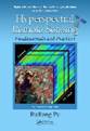
[7] Pu, R., 2017, Hyperspectral
Remote Sensing: Fundamentals and Practices, CRC Press, Taylor &
Francis Group, 466 p.
[6] Pu, R., 2017, Editorial: A Special Issue of Geosciences: Mapping
and Assessing Natural Disasters Using Geospatial Technologies, Geosciences 7,
4. There are nine papers published in 2016, vol.6, papers 18, 24, 35, 40, 42,
44, 45, 48, and 56.
[5] Pu, R., 2014,
Chapter 14, Tree Species Classification, in Remote Sensing of Natural
Resources, G. Wang and Q. Weng, Editors, CRC Press, Taylor &
Francis Group, pp. 239-258.
[4] Pu, R., 2013, Chapter 10, Estimating
and Mapping Forest Leaf Area Index Using Satellite Imagery, in Advances
in Mapping from Remote Sensing Imagery: Techniques and Applications, X.
Yang and J. Li, Editors, CRC Press, Taylor & Francis Group, pp. 225−260.
[3] Pu, R., 2011,
Chapter 19, Detecting and Mapping Invasive Plant Species by Using Hyperspectral
Data, in Hyperspectral Remote Sensing of Vegetation, P. S. Thenkabail,
J. G. Lyon and A. Huete, Editors, pp. 447-465.
[2] Pu, R. and P. Gong,
2011, Chapter 5, Hyperspectral Remote Sensing of Vegetation Bioparameters,
in Advances
in Environmental Remote Sensing: Sensors, Algorithm, and Applications,
Q. Weng, Series Editor, pp. 101-142.
[1] Li, Z., J. Jin, P. Gong and R. Pu , 2006, Use of Satellite Remote Sensing Data for Modeling
Carbon Emissions from Fires: A Perspective in North America (Chapter 18), in Qu
et al. (Eds), Earth
Science Satellite Remote Sensing, Springer-Verlag,
337-356.
· Book reviews and
dictionary items:
Pu, R., 2011, Book review for Remote
Sensing for Ecology and Conservation: A Handbook of Techniques, Written by Ned
Horning, Julie A. Robinson, Eleanor J. Sterling, Woody Turner, and Sacha
Spector, PE&RS, published 77(8): 767-
Pu, R., 2010, Book review for Advances
in Photogrammetry, Remote Sensing and Spatial Information Sciences: 2008 ISPRS
Congress Book, Edited by Zhilin Lin, Jun Chen and
Emmanuel Baltsavias, PE&RS, published 76(6): 646-
Pu, R., 2010, Thermal Imagery, in
Encyclopedia of Geography. SAGE Publications. Editor, Barney Warf, Vol 6, pp.
2819-2821. 12 Nov. 2010.
<http://www.sage-ereference.com/geography/Article_n1132.html>.
The Dataset Publications
Pu, R., Z. Li, P. Gong, I.A. Csiszar, R.
Fraser, W.M. Hao, and S. Kondragunta. 2018. ABoVE: AVHRR-Derived Forest Fire Burned Area-Hot Spots,
Alaska and Canada, 1989-2000. ORNL DAAC, Oak Ridge, Tennessee, USA. https://doi.org/10.3334/ORNLDAAC/1545
· Refereed
Articles Originally in Chinese (25 Articles/Books)
[Research Projects before 2005]
![]() Outlines of Monitoring of Sudden Oak Death Using Hyperspectral
measurements
Outlines of Monitoring of Sudden Oak Death Using Hyperspectral
measurements
![]() Outlines of NASA Historical Burning Scar Mapping in North
America using NOAA/AVHHRR Data
Outlines of NASA Historical Burning Scar Mapping in North
America using NOAA/AVHHRR Data
![]() Outlines of Wildland Fire Mapping in California with
NOAA/AVHHRR Data
Outlines of Wildland Fire Mapping in California with
NOAA/AVHHRR Data
![]() Outlines of Irrigated Tract Analysis Using Landsat TM Imagery
& DEM Data
Outlines of Irrigated Tract Analysis Using Landsat TM Imagery
& DEM Data
![]() Outlines of Land Systems Classification with Forestry and GIS
Data
Outlines of Land Systems Classification with Forestry and GIS
Data
![]() Outlines of LAI Estimation with High Spectral Resolution Images
Acquired on Airborne
Outlines of LAI Estimation with High Spectral Resolution Images
Acquired on Airborne
Updated on April 19, 2018